Services
Services
SaS - Survey as a Service
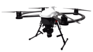
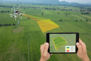
SaS – Survey as a Service gives an eagle eye view for the farmer to enhance the decision making process. Understanding the layout of the land and combined with the AGVIEW360 mapping contours overlay function, a farmer is easily and readily able to make confident decisions on possible water flow and where barriers, such as trees can be felled to divert water. Firebreak and mitigation planning is a key part of ensuring your best practices are implemented and backed up with a visual representation.

Mapping Services
- Infrared camera – FLIR is used to produce a thermal image on a video monitor and perform temperature calculations. This is beneficial in counting stock and detecting feral animals on your farm;
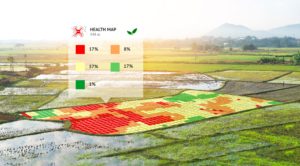
- Multispectral camera –enables the farmer to capture the data they need to react to problems caused by extreme climate changes, weeds, pests and diseases, over-planting, improper irrigation, inconsistent application of fertiliser, poor drainage and, a host of other problems that impact the health of crops;
- High resolution Camera for aerial mapping with video capability;
- Outdoor motion detection camera to monitor livestock at waterholes, feeding stations and to detect feral animals on your property;
- All of this come with the appropriate training and installations and maintenance!

AGVIEW360 RPA Integration
From the desktop to your mobile, all aspects can be covered with the RPA integration with AGVIEW360 software. This hybrid integration of services and technology allows you:
- Paddock and vegetation NVDI mapping to understand grazing patterns and pasture available. This data can be compared against the movement of livestock via the trackers for planned access to specific paddocks;
- Remote on-farm asset inspections (water points, dams, gates, fences, livestock, tractors, motorbikes); and
- Farm security (fence conditions and ingress of native fauna, wild dogs, or trespassers).
The benefits of drones as part of the farming ecosystem gives back to the farmer and stations hands a higher degree of efficiency and pin point areas which require attention immediately or can be project planned for coming weather events, planting and joining etc.


